AI Feature API
The AI Feature API allows you to retrieve a small Area of Interest (AOI) from our vector map that exists for our AI content. You can use your Nearmap AI export credits to extract a single building at a specific location to the AOI enclosed by a property, or even a small neighborhood.
AI Feature API
The AI Feature API allows you to retrieve a small Area of Interest (AOI) from our vector map that exists for our AI content. You can extract a single building at a specific location to the AOI enclosed by a property, or even a small neighborhood to access pre-processed geospatial features such as roofs, trees, pools, and solar panels. A companion API, the Rollup API further aggregates these features into a single-row tabular summary per request.
All you need to provide is a polygon for your Query AOI, an optional date range, and your Nearmap API Key. The AI Feature API allows programmatic access to different generations of Nearmap AI.
When to use the AI Feature API
- Distributed AOIs: If you have a number of small areas of interest that are distributed broadly rather than clustered in a contiguous region. For example, assessment of property parcels for an insurance carrier.
- Large data sets: If your AOI crosses multiple regions, it is best to use the date query in the AI Feature API. This allows you to extract the latest result available for each property regardless of the survey regions to which you require access.
- Regular updates: For customers who continuously update their data set in a transactional way, the API can be used to automate this rather than relying on a user to frequently export via MapBrowser.
- Real-time access: Customer-facing applications that require real-time retrieval of Nearmap AI content are well suited to API access. Because all our AI content is pre-processed, the time taken to retrieve the results is typically faster than on-the-fly AI processing systems.
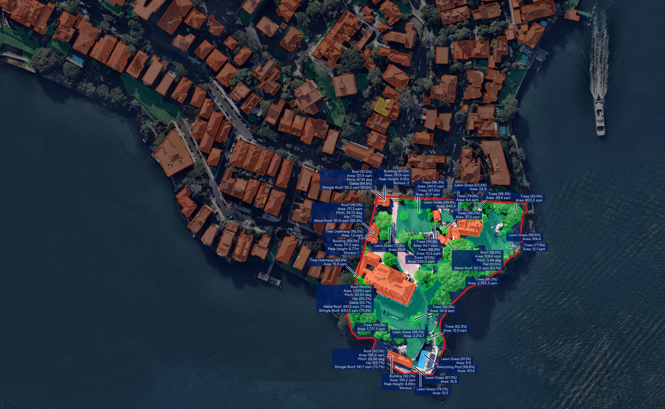
Illustration of defining a Query AOI (outlined in red) on our vector map, and returning some of the features and attributes. The data necessary to visualize the shapes and metadata within the Query AOI is all included in a single API payload.
When to use the Rollup API
The Rollup API queries AI Feature API data to provide a summary of the contents of the query AOI. It is best best suited for users who want property facts without needing to handle geospatial operations themselves. The Rollup API:
- Removes features only marginally inside the AOI boundary. For example, a building where only a very small area is within the query AOI.
- Summarizes counts, total areas, and aggregate confidence scores. For example, for an AOI with multiple roofs, the Rollup API will return facts such as roof count, total tile roof area, total metal roof area, total ponding roof area, and so on.
- Identifies the primary object for key feature classes (for example, the largest roof in an AOI).
- Flattens nested feature hierarchies into a flat CSV or JSON row
Output formats: CSV, JSON, GeoJSON
Data Dictionary Links
- Gen 6 rollup data dictionary - Click here to download
- Gen 5 rollup data dictionary - Click here to download
- Betterview data dictionary - Click here to download
Accessing the API
If you already have access to the relevant AI Packs, and an appropriate number of Nearmap AI credits, all you need to do is ask your account manager to add the AI Feature API product to your subscription. This leverages the shared Nearmap AI credit balance and AI Pack configuration - just think of it as an additional way to access the data to which you have already subscribed.
Note: The API specification contains some fields marked x-internal. These fields are intended for Nearmap internal use only and must not be used in production integrations.
Available endpoints
- Use the AI Feature API to retrieve a small Area of Interest (AOI) from our vector map.
- Use the AI Rollup API to retrieve a summarized, single row result per request.
Updated 5 months ago