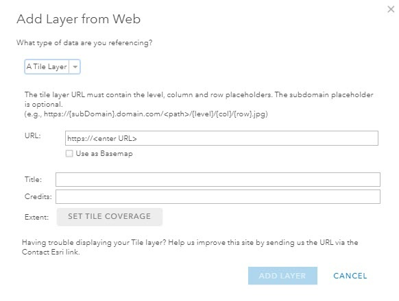
Tile API
Access Nearmap's Vertical and Panorama imagery via a Tile API using Google Maps Tile Coordinates also known as Slippy Tilenames.
Use the Tile API to stream Nearmap Vertical and Panorama imagery tiles into your application. Tiles are served in the de-facto web mapping standard, Web Mercator (EPSG:3857), using the XYZ tile scheme (also known as Google Maps Tile Coordinates or Slippy Tilenames).
When to use the Tile API
The Tile API is the right choice when you need:
- A slippy map that users can pan and zoom
- Control over tile upscaling behavior
- The ability to suppress low-resolution satellite background tiles
- Explicit survey tile requests (show imagery from a specific survey date)
- JPG or PNG tile format selection
- Relative date queries, for example, imagery that is at least one year old
If you need a different projection, or are working inside an off-the-shelf GIS application, use the WMS API instead.
Overview
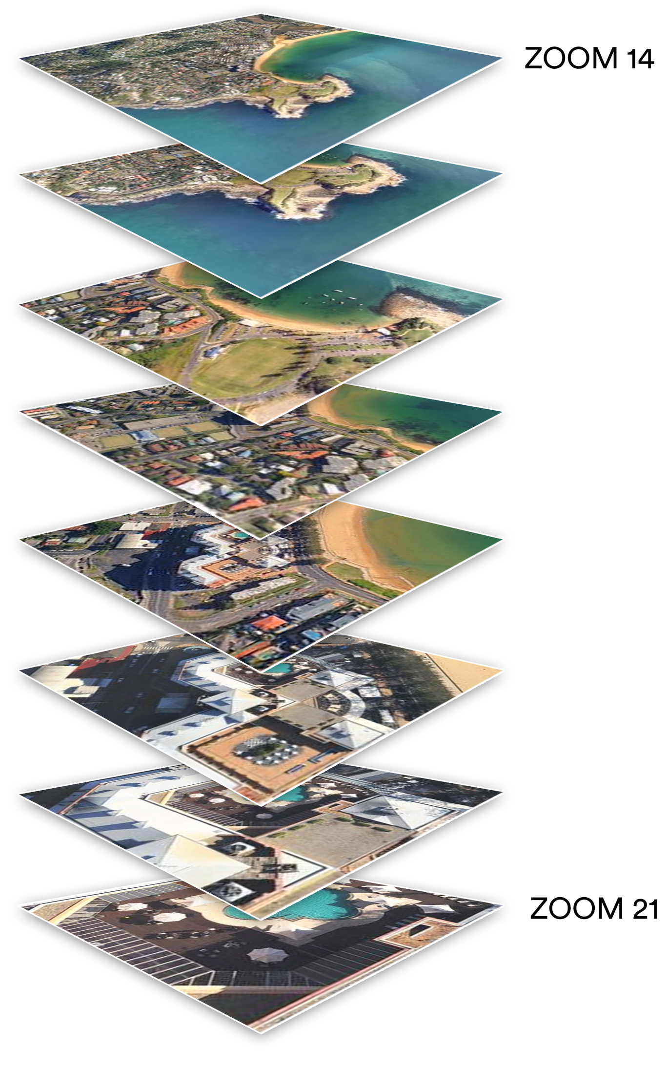
Nearmap provides access to its Vertical and Panorama Imagery via a Tile API using Google Maps Tile Coordinates, also known as Slippy Tilenames. Tiles are arranged in a pyramid of 256 × 256-pixel images at multiple zoom levels. An application typically downloads a collection of adjacent tiles to cover a region. Only the Web Mercator projection is supported, as per the de-facto web mapping standard (EPSG:3857; also known as EPSG:3785 and EPSG:900913). Nearmap’s Web Map Service (WMS 2.0) is recommended for other projections.
We recommend using a mapping framework designed to consume tiled maps such as OpenLayers, Leaflet, or the Google Maps JavaScript API rather than requesting tiles individually.
Available endpoints
Use the Coverage API to retrieve a list of available survey IDs for a location before requesting survey-specific tiles.
Rate limiting
The Tile API is rate limited. The current limit is returned in the response headers for each request. See the Nearmap API Standard for details on rate limit headers and retry behavior.
Updated 4 months ago